Who will be the new World Champion?!
Riders are free to roam in the event, using a GPS tracker they must cover as much distance and gain as much altitude as they can, safely, in 90 minutes!
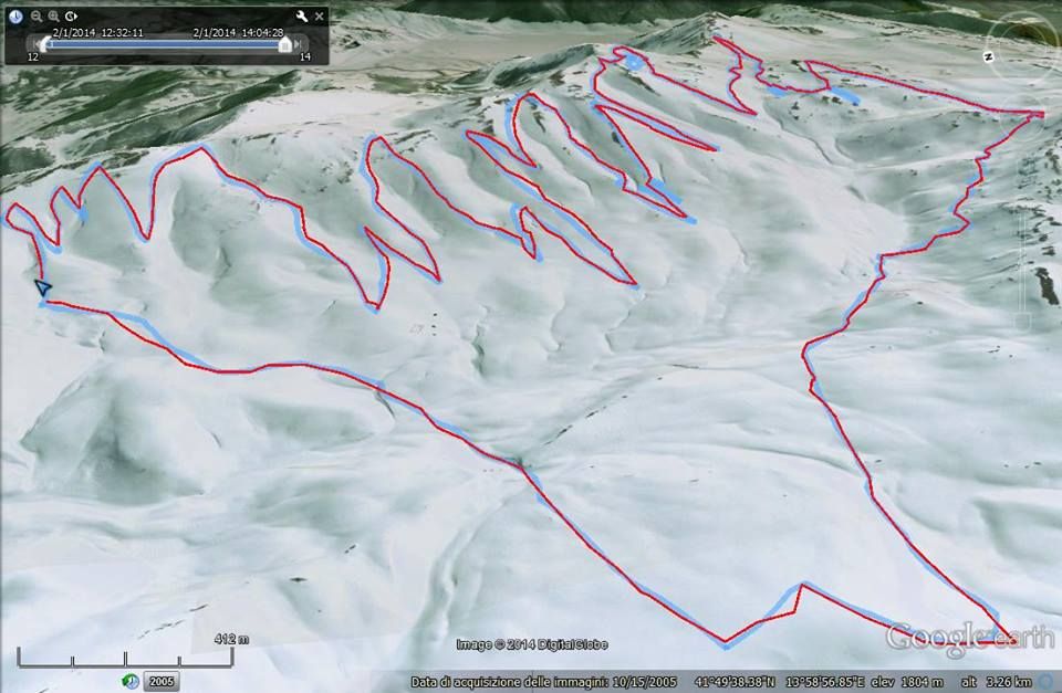
For Example here's Didier Botta's data from the 2014 event: Red line is the perimeter blue line is the distance.
Here's a video with more info on the event made during last year's event by Boulgakoff:
System analysis of GPS data:
Kitetracker.com has revealed today the reference platform for the analysis of GPS data in snowkiting and in other sports. The platform will automatically calculate parameter settings when the data is uploaded.
Action Camera:
The contest GPS not having predetermined routes and covering up a large area in order to be covered by the images recommends the athletes to bring their action camera after competitions the images will be assembled to realize the video of the event.
Selection of Pro Athletes:
In order to have the strongest riders we have chosen the following selection modes:
The main companies called to select their best riders:
- Ozone
- Flysurfer
- Rapace
- Elf Kite
- kitech
- Aeros
- HQ
- Flexifoil
- Peter Lynn
Competitions Snowkiting:
Ozone Snowkite Masters and Snowkitemaster will have the opportunity to invite athletes who they feel are best.
Snowkiting Team:
The team will present to propose the participation of their riders
- Ozone
- Kitetracker
- Ride UP
- HQ
- Skite alp
- Snowkitetonale
- Accaemme
- Foxkite
Security:
The competition does not have predetermined GPS routes and each rider decides according to their possibilities which way to go. For this reason, the organization may limit the spot in amplitude and indicate some major dangers but can not predict signs all over the spot. Each rider must be aware of the risks involved. Is advisable to study the spot before the race and eventually arriving in previous periods to test the field.
It absolutely necessary that participants bring with them their active and passive safety devices, telephone and radio to keep in touch with the organization. All participants will have to leave the starting gate and return at the appointed time in the gate and will be relatively autonomous, there will in fact be a window of 15 minutes to go, and after a time of 2 hours will have to go over the gate and stop their GPS.
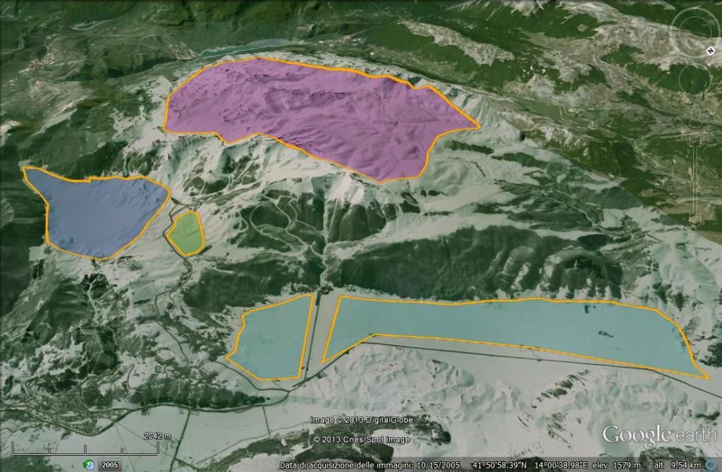
Here's a general map of the potential spot: