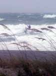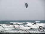
Going to be a wild weekend in Florida! See you all out there!
boost
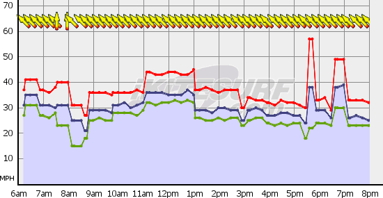
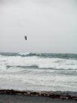
SATURDAY
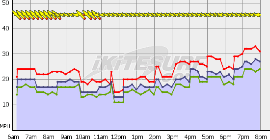
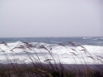
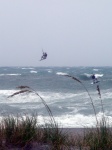
SOUTHEAST WINDS 20 TO 25 KNOTS. SEAS 7 TO 8 FEET.
INTRACOASTAL WATERS ROUGH. NUMEROUS SHOWERS AND THUNDERSTORMS.
SATURDAY NIGHT
SOUTHEAST WINDS 20 TO 25 KNOTS. SEAS 6 TO
9 FEET. INTRACOASTAL WATERS ROUGH. SCATTERED SHOWERS AND ISOLATED THUNDERSTORMS.
SUNDAY
SOUTHEAST WINDS 20 TO 25 KNOTS. SEAS 6 TO 8 FEET.
INTRACOASTAL WATERS ROUGH. SCATTERED SHOWERS AND ISOLATED THUNDERSTORMS.
SUNDAY NIGHT
SOUTH WINDS 15 TO 20 KNOTS. SEAS 3 TO 5 FEET.
INTRACOASTAL WATERS CHOPPY. SCATTERED SHOWERS.
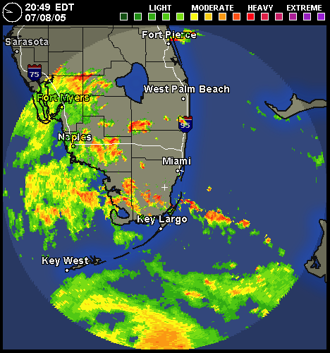
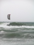
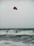
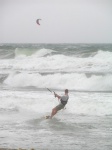
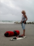
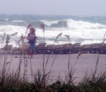
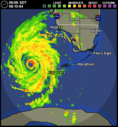
IF, folks decide to kiteboard be sure to checkout color radar, real time wind and hazard forecast carefully. More ideas about this at: http://fksa.org/viewtopic.php?t=130 Last year some guys even had laptops by the beach on aircards to monitor incoming squalls. They picked launches with large gaps between squalls and feeder bands. If it looked like something was coming in, they came in and secured a long time before any change in wind, temperature happened. Having airhorns to warn riders would be a good idea for those that choose to risk it. Even with color radar and visual observation your risk of serious injury goes up in such weather, obviously.
This is SERIOUS stuff guys. There was a rider killed in Utah and another killed in Okinawa by violent weather both quite recently. The fatality in Okinawa may have been related to a nearby Typhoon (hurricane in this hemisphere). This sort of weather is full of downbursts. Lots more about this hazard at: http://fksa.org/viewtopic.php?t=801
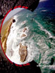
A sad record from last summer.
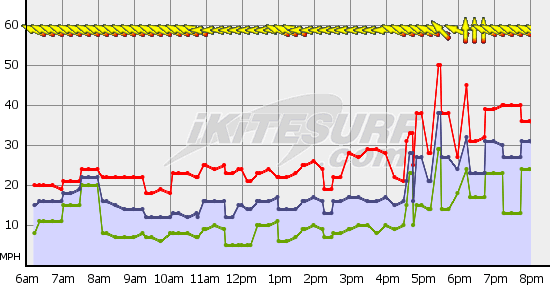
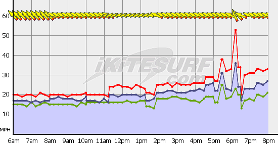
See those feeder bands, the ones with the bright colors? Those can toss out violent gust spikes, 20, 30 to 50 + knots above background windspeed. Guys have already died and come close to it establishing the hazards of riding in unstable and tropical weather systems. Try to learn from the past or be fated to repeat it. More about an EARLY case of storm related lofting and injury at: http://fksa.org/viewtopic.php?t=210
Experienced kites/windsurfers in Europe go out on windsurfers when excessively gusty wind comes along. It is harder to get lofted 100 ft. plus on a windsurfer.
Be careful out there better still, live to kite another day.
FKA, Inc.
transcribed by:
Rick Iossi